Welcome to the Bay of Kotor
Kotor Bay: Geographical Position
Boka Bay (mne. Boko-Kotorski zaliv) is the biggest gulf of Adriatic Sea and it’s listed as one of the 25 most beautiful bays in the world.

The Bay goes 28 km into the mainland. Total area of the Bay is 87.3 km2, length of coastline is 105.7 km, and the entrance is almost 3 km wide. Water salinity is 28%.
Bay is on the southeast side bordered with limestone massifs of Lovćen (1749m) and the north-west branches of Orjen (1895m), Radostak (1446m) and Dobroštica (1570m). Just above the town of Perast and between these mountains extends limestone massif Kason (873m).
On the northwest side of the entrance to the Bay is Vitaljinsko Peninsula and the South East another peninsula, Luštica. These two peninsulas are separated by the Strait of Sharp. Inside the bay there are two peninsulas Vrmačko and Devesinjsko, which separates the Strait of Verige. Straits Verige divides Boka Bay on the two outer bay, and Herceg-Novi (or Topljanski) and Tivat Bay, and two inner bays of Risan and Kotor.

So, Bay of Boka is formed out of 4 smaller bays – The Bay of Herceg Novi, situated between the capes of Arza and Oštra, as well as the isle of Mamula. From the Bay of Herceg Novi, through the Kumbor strait, we come into the Bay of Tivat. These bays made a basin of Boka Bay and are connected with other two bays – Kotor and Risan, with the narrowest but most beautiful strait of Verige.
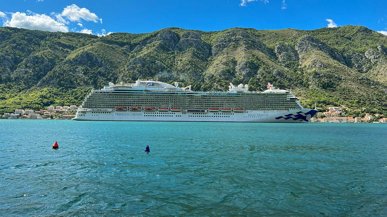
Depth of the sea in the Bay is really impressive and varies from 20m (27.3 is the average) up to 60m (at its deepest point at Verige Strait), which allows giant cruiser ships to freely enter the Bay all the way to the city of Kotor.

Boka is decorated by seven different islands, namely: Mamula (Lastavica), Our Lady of the Rocks, Saint George, St. Marko, Charity, Flower Island and Little Lady.
Along the shore there is a chain of small towns and villages where every local fisherman could tell an interesting story about.
NATURAL VALUES
Area of the Bay of Boka, viewed as geomorphological and plant-geographical entity, is very rich in nature, that with special features makes an unusual contrast of relief, the remains of the tectonic disturbances, lime surfaces, as well as the deciduous vegetation in the coastal zone.

Given that stretches between the Adriatic Sea and Karst hinterland area of the Bay of Kotor is under the influence of Mediterranean and mountain climate, which, when are mixed to form a special kind of sub-Mediterranean climate, quite specific, unlike the rest of the coastline. With this type of climate, the average air temperature in January is 7 degrees, and in July around 23 degrees Celsius.
Thus, characteristic for Boka is the early spring, when all the surrounding mountains are covered with snow, on the coast of the Mediterranean blooming plants and trees. In winter it can also be enjoyed in the sunny days on the coast while in the mountainous region can be reached in less than an hour. Summers in this region are pleasant with more rainy days than the rest of the Montenegrin coast, which is reflected in the lush vegetation.

In the Bay has the most rainy days in late autumn and partly during the winter, especially in the inner part of the bay, where high mountains are blocking way of the clouds which come from the south and bring rain. Often, in wintertime, rain don’t stop for weeks, sometime even months.

Along the entire coast of the Gulf can be seen rich distribution of Mediterranean, continental and exotic plants. Laurel, palms, olive trees, oranges, lemon and pomegranate, agave, oleanders, camellias, mimosas and others – are only a part of wide colorful flora of the region.

Besides, Bay of Boka is very favorable for the development of shells, because of many sources of fresh water (especially at Orahovac), which affects the decrease in salinity. In previous years, growing of mussels has surpassed all expectations.
SETTLEMENTS
Along the Bay is scattered a series of smaller and larger settlements among which there are three cities – Herceg-Novi, Kotor and Tivat.

Each of Boka Boka village and each city has its own specifics that equally attractive. While the main feature of Herceg-Novi is its rich natural botanic garden, Kotor is adorned by numerous cultural and historical monuments, and Tivat has its advantage in a nautical component of its tourist offer. Certainly the whole coast has many beaches and swimming areas, of which more are on the Herceg-Novi and Tivat Riviera, while the smaller, more intimate hidden along Kotor Riviera.
HERCEG NOVI RIVIERA
Herceg Novi Riviera stretches over a length of 15 km and comprises 7 villages and tourist places, each with its particular attraction. Most popular places to visit at this part of the Bay are Meljine, Zelenika, Kumbor, Đenovići, Baošići, Bijela, Kamenari, Luštica (peninsula) and Igalo.
Igalo
Even tho Igalo and Herceg Novi makes a unique urban settlement, Igalo can be considered as a separate part, which has about 4.000 residents.
Igalo known primarily as a tourist destination, and thanks to a radioactive – sea mud from muddy beach, it is the center of medical tourism in Montenegro.

While Igalo dominates the Mediterranean Medical Centre with the same name, a bit away from it, hidden in a vegetation, there is to be find famous villa “Galeb”, one of the many official residence of of the former President of Yugoslavia, Josip Broz Tito. Coincidentally, Tito was at the spot on 15th of April 1979, when the entire Montenegrin coast hit by a catastrophic earthquake.

Epithet SPA Igalo need to thank the gentle Mediterranean climate with over 200 sunny days a year and lush vegetation, especially unexploited mineral water (Igaljanki, Igaljskoj statins) and healing, radioactive sludge.
Luštica Peninsula
Lustica is a peninsula located at the entrance to the Bay with its right hand, just across the city of Herceg Novi. Its area is 47 km2 and extends over a length of 13 km. Due to the extreme granularity, long coastline is 35 km. It is administratively divided between the municipalities of Herceg Novi and Tivat.

In the historical sources Luštica was first mentioned in the 13th century, while its rich history is supported by numerous religious buildings found at the land. It has a dozen villages, but it is low populated and all together have no more than 400 inhabitants.
Herceg Novi
Herceg Novi is a medieval town at the entrance of Boka Bay. Its characteristic feature are numerous parks and gardens, rich in diverse plants and species with foreign origin – palms, cikasi, magnolia, agave, bananas and other Mediterranean and sub-tropical plants.

With more than 200 sunny days, Herceg Novi is officially the sunniest city in Montenegro, and along with its gorgeous flora, tourist come to enjoy beautiful beach as well.
Herceg Novi (or just Novi, as the local people call it) was founded by the Bosnian king Tvrtko I Kotromanić in 1382. Its defensive role is witnessed by numerous fortresses and towers. Their names, Kanli Tower, Španjola, Forte Mare and Citadela point to the periods of time under the rule of various conquerors. Today, they are open-air stages where film, music and flower festivals are held.
Discover more about Herceg Novi.
TIVAT RIVIERA
Tivat is situated at the top of the largest bay Bay of Boka Kotorska. Unlike other towns of Boka which are limited with high elevations, Tivat has a spacious environment. It’s been separated from Kotor Bay by Vrmac hill. In Tivat Riviera we include: Lepetane, Opatovo, Donja Lastva, Tivat, Kalimanj, Župa, Bjelila and Krašići settlement.

This area is characterized by jagged coastline with many beaches and the most famous is called Blue Horizon. At this part of the Bay are also located three different islands – Stradioti (St. Marko), Our Lady of Mercy and Flower Island (Ostrvo Cvijeća).
Municipality of Tivat has great connections in air, land and sea traffic – one of two Montenegrin airport is located in Tivat, as well as is the most luxury marina, Porto Montenegro. Worth of mention is fairy connection Lepetane-Kamenari which allows travelers to shorter their journey passing Verige strait by fairy (not going all around Kotor Bay) toward Herceg Novi Riviera.
Discover more about Tivat.
KOTOR RIVIERA
In its two and a half thousand years of history, under different masters and keeping its own autonomy, Kotor has been an important political and cultural center in the in the southern part of the Adriatic Sea, particularly in the Middle Ages, as witnessed by its rich cultural heritage.

Because of its extraordinary natural beauty and rare or unique cultural values, the Bay of Kotor and Risan has been included in the UNESCO World Heritage List.
Riviera of Kotor covers coastal areas starting from Risan Bay, Perast, Dobrota, via Orahovac, Ljuta to Kotor, Muo, Prčanj and Stoliv.
Town of Kotor
The Old Town is considered to be the best-preserved medieval walled town in the entire Mediterranean. The walls themselves stretch to 20-meters high, and believe it or not, they’re over a thousand years old. The Old Town of Kotor has a great number of monuments of the medieval architecture: churches, cathedrals, palaces, and museums. Its beauty is complemented with the multitude of narrow streets, squares, and markets.
Since the early days of Greek civilization, through Illyrian culture, Roman heritage, influences of Byzantines, Venetian legacy after followed by Russians, Napoleon and Austrian Empire days, Kotor and entire Boka Bay has always been an extremely important geostrategic place for this part of the Europe.
Discover more about Kotor.
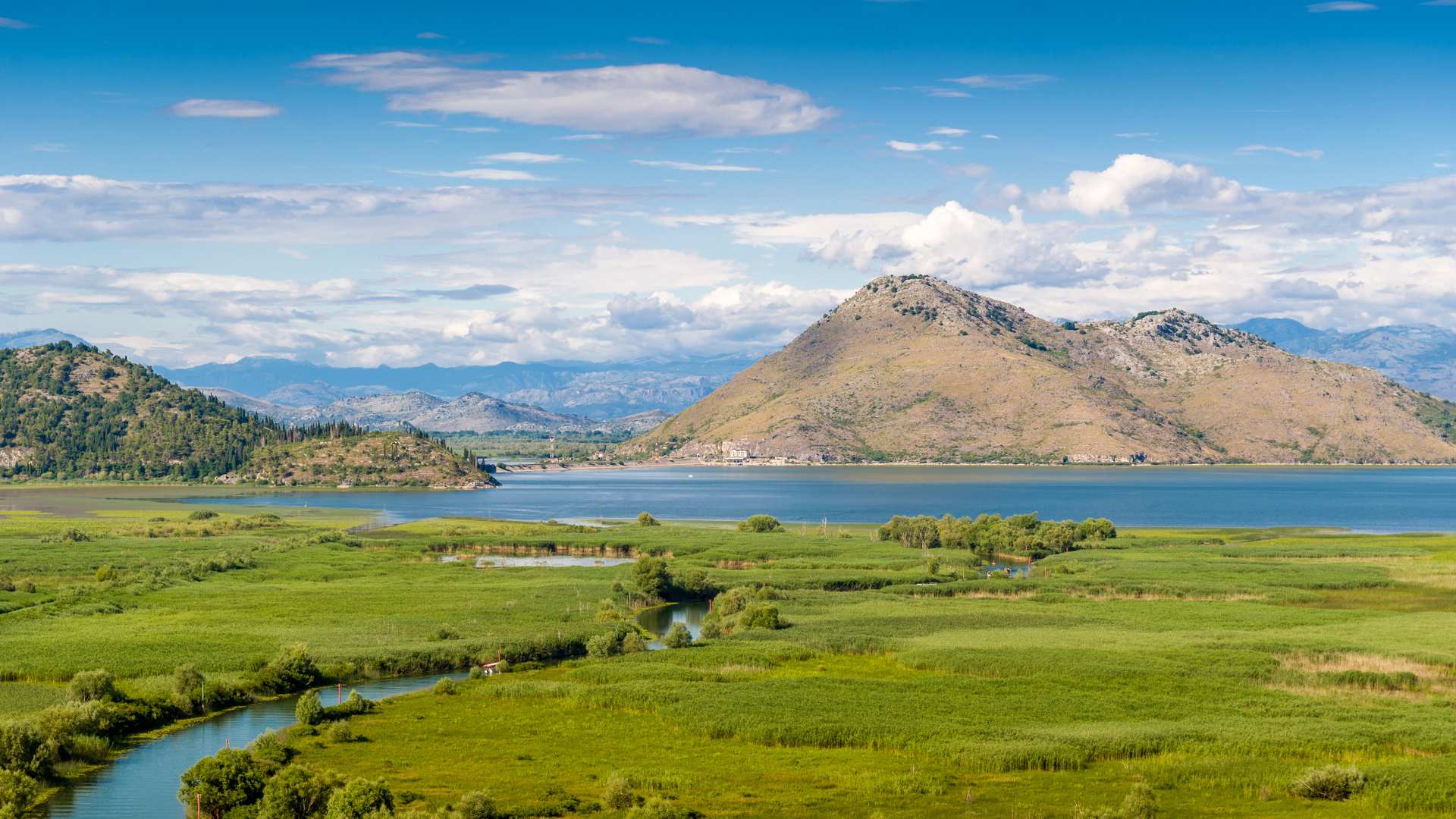
Risan Bay
Risan is the oldest settlement in Boka-Kotorska. It is mentioned in the 3rd century BC as a fortified Illyrian town, the capital of Queen Teuta. After the fall of the Western Roman Empire in 476, Risan (Rizon) was cultural and political center of the Bay, named Sinus Rhizonicus after it.

Later on, the town belonged to the rulers of Zeta State, Bosnia and Herzegovina, then to Dubrovnik Republic, then to the Turks, Venetians and Austrians.

From the early history of the town, from the 8th century BC, some drawings (dears and symbols of swastikas) on the wall of a cave close to the village of Lipci, some 500 meters from the coast, have remaind.

The most interesting finds in Risan are remnants of a larger, representative Roman housing unit with the mosaics from the end of 2nd and the beginning of the 3rd century. The preserved floor mosaics are executed in the opus tessallatum technique, which is, drawing, using pebbles of different colors, geometrical and floral ornaments. The only exception is the mosaic preserved in the north eastern part if the building which contains figure representation of Hypnos, the god of sleep.
There’s some evidence which suggest that the great earthquake caused Rissan’s original shoreline to sink and that the ancient city lies below tones of slit. Alleges has it that the Bay’s current capital Kotor was founded only because Risan sank into the Adiratic.
Perast
Small town of Perast is the most complete Baroque town on the Adriatic coast, and 16 Baroque palaces are there to confirm. It has 17 Catholic churches, many defensive towers (instead of defensive walls), and even a number of Orthodox structures. Nowadays, it’s a UNESCO World Heritage site.

Written documents began to refer to Perast in 13th century, initially as settlement of seamen, stone masons and fishermen. Although it was an ancient settlement, Perast enjoyed greater economic, political and cultural development from 15th century. This small town flourish in its best in 17th and 18th century – it was known as seafarers’ nest, center of maritime industry and trade. This period is known as the golden era of Perast.
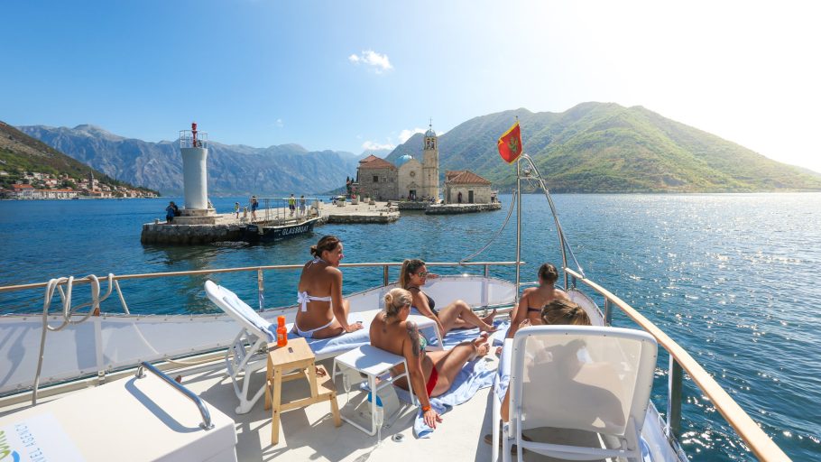
Our Lady of the Rocks and St. Georgie
The Island Our Lady of the Rocks (Gospa od Škrpjela) is one of two jewels islands in the Bay of Kotor, which are situated in the sea across Perast.

The Island Our Lady of the Rocks was made as an artificial island from more than 100 shipwrecks filled with stones. According to a legend, two seamen from Perast have found an icon of the Holy Mother of God with the Christ on a sea rock in 1452, so as the customs say they vowed to build a Catholic Church for that icon. They had no land to build it on, so they start building the isle first. Finally, the Church was built in 1630. As the island had to be maintained, the seaman continued to bring the stones and rocks, and that tradition is alive even today. This event is called Fašinada and it is held on every 22nd of July.

The other, darker island, is the Island of St George (Sveti Đorđe). That island is natural and it used to be a cemetery for all nobility from Perast. Now there is an Orthodox Church.
With its many natural and historical beauties, it is certainly not possible to discover Boka entirely in one breath. And that is the very charm of this place – with each visit you can experience something new.
We highly recommend that while you are at the Bay, you should not be tied only to one place, but should explore and enjoy all the benefits that this place provides.
12 hours
Great Montenegro Tour: Top Guided Tour in Montenegro
69€ per person
8 hours
Kotor Cruise: The Best Boat Tour From Kotor
84€ per person

13 hours